
微信小程序_(map)简单的小地图
2023-09-14 08:57:05 时间
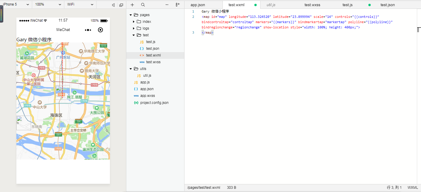
map地图效果 官方文档:传送门


Page({
  data: {
    markers: [{
      iconPath: "/resources/others.png",
      id: 0,
      latitude: 23.099994,
      longitude: 113.324520,
      width: 50,
      height: 50
    }],
    polyline: [{
      points: [{
        longitude: 113.3245211,
        latitude: 23.10229
      }, {
        longitude: 113.324520,
        latitude: 23.21229
      }],
      color: "#FF0000DD",
      width: 2,
      dottedLine: true
    }],
    controls: [{
      id: 1,
      iconPath: '/resources/location.png',
      position: {
        left: 0,
        top: 300 - 50,
        width: 50,
        height: 50
      },
      clickable: true
    }]
  },
  regionchange(e) {
    console.log(e.type)
  },
  markertap(e) {
    console.log(e.markerId)
  },
  controltap(e) {
    console.log(e.controlId)
  }
})
Gary 微信小程序
<map id="map" longitude="113.324520" latitude="23.099994" scale="14" controls="{{controls}}" bindcontroltap="controltap" markers="{{markers}}" bindmarkertap="markertap" polyline="{{polyline}}" bindregionchange="regionchange" show-location style="width: 100%; height: 400px;">
</map>
{
  "pages":[
    "pages/test/test",
    "pages/index/index",
    "pages/logs/logs"
  ],
  "window":{
    "backgroundTextStyle":"light",
    "navigationBarBackgroundColor": "#fff",
    "navigationBarTitleText": "WeChat",
    "navigationBarTextStyle":"black"
  }
}
实现过程
添加map地图组件
<map id="map" longitude="113.324520" latitude="23.099994" scale="14" controls="{{controls}}" bindcontroltap="controltap" markers="{{markers}}" bindmarkertap="markertap" polyline="{{polyline}}" bindregionchange="regionchange" show-location style="width: 100%; height: 400px;">
</map>
id:在控件点击事件回调会返回此id
markers标记点用于在地图上显示标记的位置
longitude :经度
latitude: 纬度
scale:缩放级别,取值范围为5-18
controls:控件名称
bindcontroltap: 点击控件时触发,会返回control的id
markers:标记点
bindmarkertap:点击标记点时触发,会返回marker的id
polyline:路线
bindregionchange: 视野发生变化时触发
show-location:显示带有方向的当前定位点
初始化地图路线、路线
  data: {
    markers: [{
      iconPath: "/resources/others.png",
      id: 0,
      latitude: 23.099994,
      longitude: 113.324520,
      width: 50,
      height: 50
    }],
    polyline: [{
      points: [{
        longitude: 113.3245211,
        latitude: 23.10229
      }, {
        longitude: 113.324520,
        latitude: 23.21229
      }],
      color: "#FF0000DD",
      width: 2,
      dottedLine: true
    }],
    controls: [{
      id: 1,
      iconPath: '/resources/location.png',
      position: {
        left: 0,
        top: 300 - 50,
        width: 50,
        height: 50
      },
      clickable: true
    }]
  },
相关文章
- 使用 Java8的 stream对list数据去重,使用filter()过滤列表,list转map「建议收藏」
- 数组类型的字符串转List<Map>
- java中map转json[通俗易懂]
- java map转json字符_Map转JSON字符串
- 微信小程序官方组件展示之地图map源码
- C++map的遍历_Map集合循环遍历的几种方式
- js forEach和 map 区别
- Map的5种遍历方法
- 【Kotlin】集合操作 ⑤ ( Map 集合 | 获取 Map 值 | Map 遍历 | 可变 Map 集合 )
- Go语言sync.Map(在并发环境中使用的map)
- Redis实现快速存储Map(redis存map)
- 使用Redis轻松操作Map数据结构(redis操作map)
- 使用Redis存储Map结构数据(将map存到redis中)
- 警惕Redis Map的频繁变更(redis频繁修改map)
- 基于Redis集群的Map数据结构的删除(redis集群map删除)
- Oracle Map映射从实施到实现(oracle map映射)
- 使用Oracle Map方法开启新视野(oracle map方法)
- 科学上网如何使用Oracle MAP(oracle map使用)
- js实现的map方法示例代码